GPS tracking works by your device picking up signals from satellites orbiting Earth. These signals tell your device how far away each satellite is. By combining data from at least three satellites, your device can figure out your exact location in real time. Weather, buildings, and trees can sometimes interfere, but technology continuously improves accuracy. If you want to understand how all these pieces fit together and work seamlessly, keep exploring.
Key Takeaways
- GPS devices receive signals from multiple satellites orbiting Earth to determine their exact location.
- The device calculates how long it takes for signals to arrive, helping it measure distances from satellites.
- By analyzing signals from at least three satellites, it figures out its precise position through a process called triangulation.
- External factors like buildings or weather can sometimes interfere with signals and affect accuracy.
- The device continuously updates its location, allowing real-time tracking and navigation on maps.
What Is GPS Tracking and How Does It Work?
Have you ever wondered how GPS tracking can tell you exactly where you are? It all starts with understanding what GPS tracking is. Essentially, GPS devices use signals from satellites to pinpoint your location in real-time. To keep these devices working well, regular GPS device maintenance is essential—like checking batteries and updating software. The historical development of GPS began with military origins in the 1970s, evolving into the widely available technology we use today. This development has made navigation more accurate and accessible. Your GPS device continuously receives signals from multiple satellites, calculates your position, and updates your location on maps instantly. Behind the scenes, a combination of technology, satellite signals, and ongoing device maintenance keeps you informed about exactly where you are. Additionally, advances in satellite technology have contributed to the increased precision and reliability of GPS systems over time. Modern GPS systems also incorporate real-time data processing to improve accuracy and responsiveness in various environments. Furthermore, improvements in system accuracy ensure that your location data remains precise even in challenging conditions. The integration of advanced algorithms further enhances the overall performance of GPS tracking devices, making them more dependable for everyday use.
How GPS Satellites Help Find Your Location
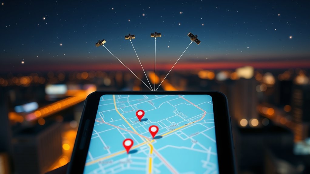
GPS satellites transmit signals that your device receives to determine your position. Using a process called triangulation, your device measures the distance from multiple satellites to pinpoint exactly where you are. This combination of signals and calculations results in an accurate location displayed on your screen. Additionally, Vetted – Floating on Water techniques are sometimes used in conjunction with GPS to enhance navigation in challenging environments or on water bodies, ensuring reliable positioning even when signals are weak or obstructed. These techniques help maintain precise location data in environments where traditional signals might be unreliable, especially in areas with wave and wind interference. Incorporating insights from sustainable travel practices, some advanced systems aim to optimize signal use to minimize environmental impact and energy consumption.
Satellite Signal Transmission
Satellites in space transmit signals that your GPS device detects to determine your location. These signals travel through space using principles of orbital mechanics, which keep satellites in precise, predictable paths around Earth. When your device receives these signals, it measures how long they took to arrive, which helps calculate the distance to each satellite. Understanding orbital mechanics ensures that satellites maintain accurate positions for reliable GPS signals. Additionally, the timing of signals is crucial for precise location calculation, making synchronization vital for GPS accuracy. However, signal interference from buildings, weather, or atmospheric conditions can sometimes disrupt this process, making it harder to get an accurate fix. Despite these challenges, GPS satellites continuously send out strong, synchronized signals, ensuring your device can reliably pinpoint your position. This constant stream of data is essential for accurate navigation, helping you find your way even when signals face obstacles or interference.
Triangulation Methodology
To determine your exact location, GPS devices use a technique called triangulation, which involves analyzing signals from multiple satellites simultaneously. The triangulation technique measures the time it takes for signals to reach your device, and the signal strength helps confirm the satellite’s position. By comparing data from at least three satellites, your GPS can pinpoint your location accurately. Here’s a simple overview:
| Satellite | Signal Strength | Distance Estimate |
|---|---|---|
| Satellite A | Strong | 10,000 km |
| Satellite B | Moderate | 12,000 km |
| Satellite C | Weak | 14,000 km |
This table shows how signal strength influences distance calculations, enabling your device to locate you precisely through triangulation. Additionally, factors like satellite geometry can affect the accuracy of the positioning. Understanding the regulatory environment is also important, as it can impact the operation and data handling of GPS devices in different regions.
Accurate Location Calculation
When your device receives signals from multiple satellites, it uses the timing information to calculate your exact location. By measuring how long each signal takes to arrive, your device determines its distance from each satellite. Combining these measurements helps improve mapping precision, giving you a pinpoint accurate position. Additionally, support breakfast options like high-protein meals can help keep you energized during outdoor activities, especially when navigating through challenging environments. The process also depends on accurate timing to ensure the signals are synchronized correctly, which is crucial for precise location calculation. However, signal interference from tall buildings, weather, or dense forests can disrupt these signals, reducing accuracy. Modern GPS receivers use advanced algorithms to filter out noise and correct errors caused by interference. This process relies on precise timing to guarantee your location remains as accurate as possible, even in challenging environments. The use of satellite signals with synchronized clocks allows GPS to maintain high accuracy and reliability. The result is a reliable, real-time position that helps you navigate confidently, whether you’re driving, hiking, or exploring new places. Ananda Aromatherapy offers tips for using essential oils to enhance well-being during outdoor activities.
How Your Device Connects With Satellites

Your device connects with satellites by sending and receiving signals that travel through space at the speed of light. These signals bounce between your device and satellites orbiting high above the Earth. Each satellite follows a specific satellite orbit, maintaining a fixed position relative to the planet. When your device requests location data, it transmits a signal to these satellites. Because signals take time to travel, there’s a slight signal delay, especially as the distance varies. The satellites then respond with their data, which your device receives. By measuring the time it takes for these signals to arrive, your device can determine how far away each satellite is. This process is essential for pinpointing your exact location, enabling your GPS to work accurately. Additionally, satellite communication relies on precise timing and synchronization to ensure that location information remains accurate and reliable. The accuracy of this system can be affected by factors such as atmospheric conditions and signal obstructions, but advances in navigation technology continue to improve reliability. A methodical approach in calibration and signal processing helps mitigate errors and improve overall accuracy. Furthermore, signal processing techniques play a crucial role in filtering out noise and enhancing the clarity of the data received.
How GPS Coordinates Show Your Position
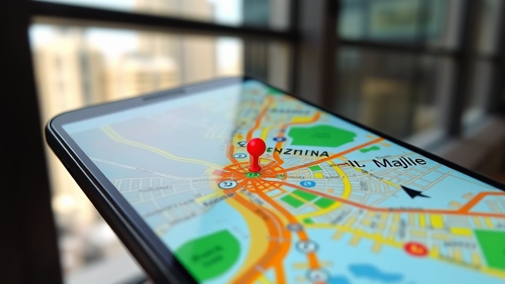
GPS coordinates translate the signals from satellites into a precise location on Earth by using a system of numbers called latitude and longitude. These coordinate systems assign specific numbers to your position, which can be plotted on maps for visualization. When your device receives satellite signals, it calculates your exact point by combining these latitude and longitude values. This process relies on satellite signals being accurately transmitted and received, which is crucial for reliable positioning. This data allows map applications to display your location accurately on digital maps, helping you navigate easily. The coordinate system acts like a universal language, ensuring your position is understood worldwide. By translating satellite signals into familiar map visuals, your device provides clear, real-time location information, making it simple to see exactly where you are and where you’re headed. Understanding satellite signals is essential for accurate positioning in various applications, especially as automotive repair increasingly incorporates advanced GPS technologies.
How Your Phone or Car Uses GPS Data in Real Time
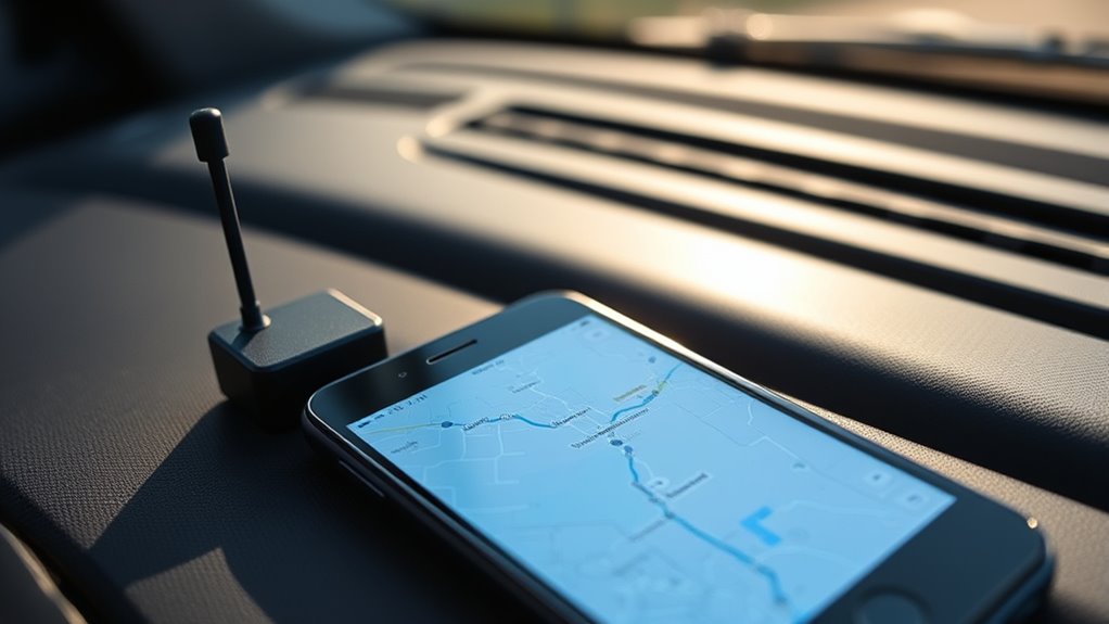
When you use your phone or car navigation, it constantly updates your location in real time to give you accurate directions. This relies on a steady satellite signal connection, which helps your device know exactly where you are. As you move, your GPS keeps tracking your position so you always stay on the right path.
Real-Time Location Updates
Real-time location updates happen seamlessly as your device constantly communicates with satellites to pinpoint your position. This data feeds into applications like map visualization, allowing you to see your movement instantly. It also helps with weather forecasting, providing precise location info for accurate weather reports. As you move, your device receives continuous signals, updating your location every second. This process ensures smooth navigation and real-time tracking. The system works so efficiently that you almost forget it’s happening behind the scenes. To illustrate, here’s a quick look at how GPS data impacts everyday use:
| Application | Benefit |
|---|---|
| Map Visualization | Accurate, live directions |
| Weather Forecasting | Precise local weather updates |
| Navigation Apps | Step-by-step route guidance |
| Ride-sharing | Real-time driver tracking |
| Emergency Services | Faster response times |
Satellite Signal Connection
Ever wonder how your phone or car instantly knows its exact position on the map? It all starts with satellites orbiting high above Earth, sending signals down to your device. Your GPS receiver picks up these signals and calculates your location based on how long it takes each signal to arrive. But satellite signals can face interference from tall buildings, dense forests, or atmospheric conditions, which can disrupt accuracy. To combat this, your device uses signals from multiple satellites, ensuring a precise fix even when some signals weaken. The receiver constantly updates its calculations, adjusting for any signal interference or slight changes in satellite orbit. This seamless process allows you to navigate confidently, knowing your device is working behind the scenes to keep your location accurate in real time.
What Factors Can Affect GPS Accuracy

Several factors can influence how accurately your GPS device pinpoints your location. Urban interference is a major factor; tall buildings and dense infrastructure can block or reflect satellite signals, causing errors. Weather impacts also play a role—heavy rain, thick clouds, or storms can weaken signals and reduce accuracy. Additionally, if you’re in a canyon or surrounded by dense trees, signals may bounce or become obstructed. Multipath errors occur when signals reflect off surfaces like buildings or water before reaching your device, leading to inaccuracies. Satellite geometry, or how satellites are positioned relative to you, also affects precision. When satellites are clustered together, your GPS’s accuracy drops. Being aware of these factors helps you understand why your location might sometimes be slightly off.
How to Improve Your GPS Signal and Accuracy

To improve your GPS signal and accuracy, start by choosing open areas away from tall buildings, dense trees, or heavy infrastructure, as these can block or reflect signals. Minimizing GPS signal interference helps your device lock onto satellites more effectively. You can also boost accuracy by following device calibration tips, such as resetting your GPS or updating its software regularly. Keep your device’s location services enabled and ensure your GPS receiver isn’t obstructed by thick cases or metal objects. Avoid using GPS indoors or underground where signals are weak. Clear skies and less urban clutter improve reception. By reducing interference and maintaining your device’s calibration, you’ll get more precise positioning, making navigation and tracking much more reliable in everyday use.
Frequently Asked Questions
Can GPS Work Indoors or Underground?
GPS generally doesn’t work well indoors or underground because your device can’t receive strong signals from satellites. However, indoor navigation and underground signals are possible with alternative systems like Wi-Fi, Bluetooth beacons, or RFID. These technologies help you find your way inside buildings or underground locations by creating local networks that don’t rely on satellite signals, ensuring you stay connected and oriented even when GPS isn’t available.
How Does Weather Affect GPS Signals?
Imagine you’re in a vintage radio broadcast, and weather interference messes with the signal—that’s similar to how weather impacts GPS. Weather can weaken satellite signals, especially during storms, heavy rain, or snow, causing inaccuracies or delays. These atmospheric conditions disrupt the transmission between satellites and your device, making your location less precise. So, just like a bad radio signal, weather interference can temporarily hinder your GPS’s accuracy and reliability.
Is GPS Tracking Always Real-Time?
Yes, GPS tracking is usually real-time, but location accuracy can sometimes be affected by signal delays. You might notice slight lags if there’s interference or poor signal reception, especially indoors or in tunnels. However, most systems update your location frequently enough to give a near-instant view of your whereabouts. So, while it’s generally real-time, occasional delays can occur, impacting precise tracking temporarily.
What Privacy Concerns Exist With GPS Tracking?
Imagine your location being a visible beacon, like a lighthouse in a foggy sea, which highlights privacy invasion risks. You might worry about data security breaches, where sensitive info could be exposed or misused. While GPS tracking offers convenience, it also raises concerns about who can access your movements, how securely that data is stored, and whether you’re unknowingly sharing too much. Protect yourself by understanding privacy settings and data policies.
How Long Does GPS Device Battery Last?
Your GPS device’s battery life varies based on usage and power management, typically lasting anywhere from a few hours to several days. If you enable power-saving features or reduce update frequency, you prolong the battery life. Keep an eye on the device’s battery indicator and recharge regularly. Proper power management ensures your GPS stays functional longer, whether you’re tracking your vehicle or outdoor adventures.
Conclusion
Now that you know how GPS tracking works, you can think of it as a digital compass guiding you through life’s maze. With satellites beaming signals like stars lighting your path, your device pinpoints your location with impressive precision. By understanding this invisible web of technology, you gain control over your navigation. So, next time you’re lost, remember—GPS is your trusty map in the sky, always ready to help you find your way home.